Several options of maps, geospatial data, aerial imagery, and LIDAR maps are available to visitors and researchers.
If you're looking for driving directions, please see our Location and Directions page.

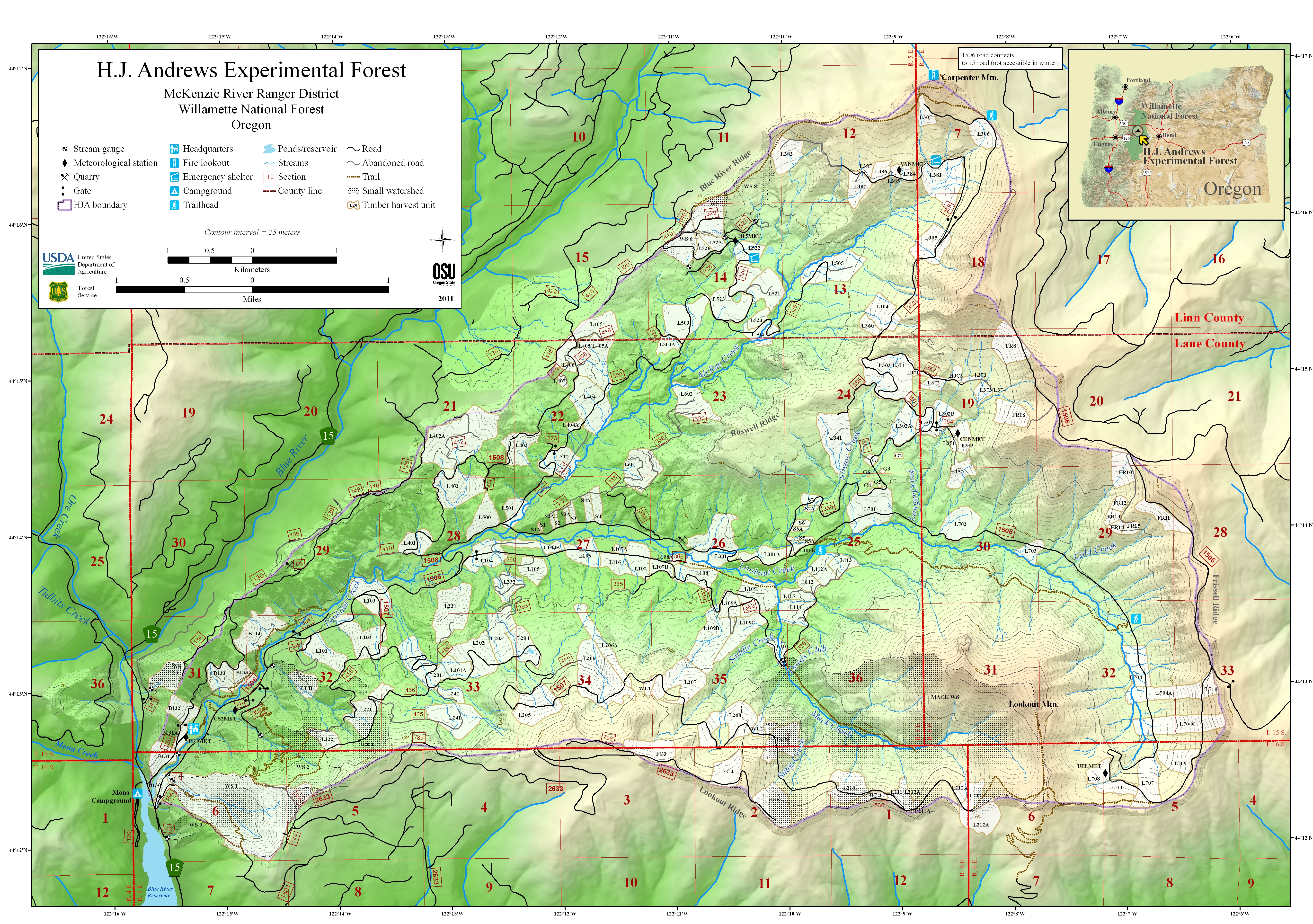
Map of the H.J. Andrews Experimental Forest
Geo-enabled PDF (18MB file). To use geo-enabled features, use a geopdf application (such as PDF Maps or Avenza Maps) on a GPS-enabled mobile device.
Basic map JPG (15MB file). This is the same map image as the geo-enabled PDF, but as a basic jpg file.
Online Spatial Data
Spatial data in gridded and vector formats are available for HJ Andrews Experimental Forest at the ArcGIS Open Data Hub. Spatial data that reside on the Hub include: hydrography data, historical imagery, LIDAR derived elevation models and base GIS layers such as roads.
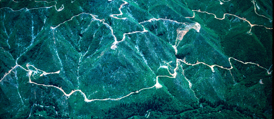
Aerial Photography
Digital (and hardcopy) aerial photographs (9x9 format) are available for the HJ Andrews for the following years:
-
1946, 1949, 1959, 1967, 1972, 1979, 1990, 1996
Make arrangements with our Information Managers for access to the aerial photographs.
Digital Orthophotography
A digital orthophoto quadrangle (DOQ) is a computer-generated image of an aerial photograph in which image displacement caused by terrain relief and camera tilts has been removed. It combines the image characteristics of a photograph with the geometric qualities of a map. The imagery can be used within a Geographic Information System (GIS) because it has been geo-referenced to the earth surface.
There are historical orthophotos available for the HJ Andrews Experimental Forest, for the following years: 1959, 1967, 1979, and 1990. These orthophotos were generated using the 2008 LiDAR Digital Elevation Model (DEM), and aerial photography. Contact our Information Managers for access to these images. Oregon Statewide aerial imagery is available on-line for 1995, 2000, 2005, and 2009 at the Oregon Explorer.
LIDAR Data and Imagery
LIDAR flights covering the Lookout Creek watershed were conducted in fall of 2008 and 2014. A flight covering the upper Blue River Watershed to the north of the Andrews Forest was completed in 2011. Access to the raw data (very large files) can be arranged by contacting our Information Managers.